Learn about Milwaukee County Research Park
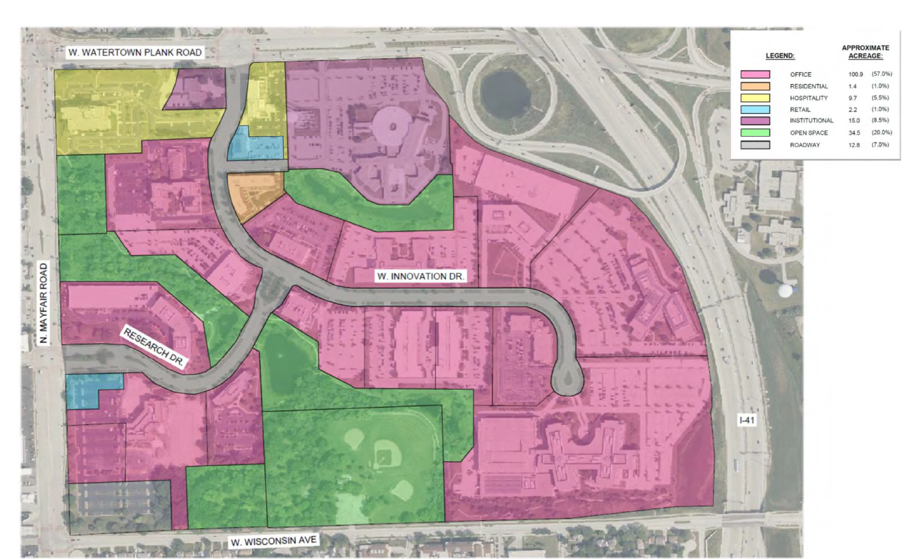
Milwaukee County Research Park, established in 1994, spans 134 acres and combines both developed properties and preserved natural areas. The park includes 20 acres of open space and conservation land, along with 20 properties: two hotels with 317 guest rooms, an apartment complex with 103 residential units, two retail buildings totaling 18,000 square feet, a 46,000-square-foot medical office building, and 14 office buildings providing more than 1.8 million square feet of space. At peak capacity, the park is home to approximately 6,000 employees.
About the Master Plan
The City of Wauwatosa and Irgens entered into a joint master planning agreement in March 2025.
This study includes:
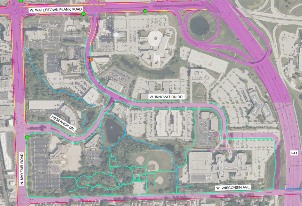
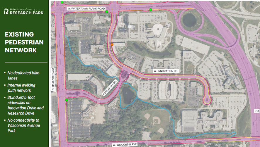
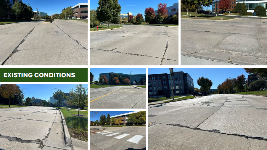
- Review of existing infrastructure (roads, utilities, stormwater, transportation/connection)
- Addition of new common amenities
- Transportation flow (pedestrian, bicycling, vehicular)
- Opportunities for new building projects to enhance taxable value
- Review of current zoning and opportunities to create a multi-use community environment
- Connection to neighbhoring uses, such as Wisconsin Avenue Park and other community assets
Goals:
- Prioritize pedestrian and bicycle connectivity. Create safe, attractive, and accessible pedestrian pathways and bike trails that connect buildings, amenities, and surrounding neighborhoods, promoting alternative modes to lessen the reliance on cars.
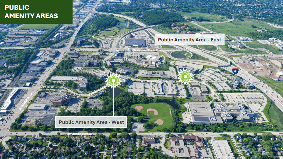
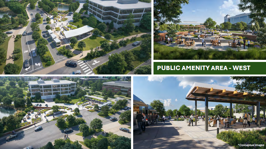
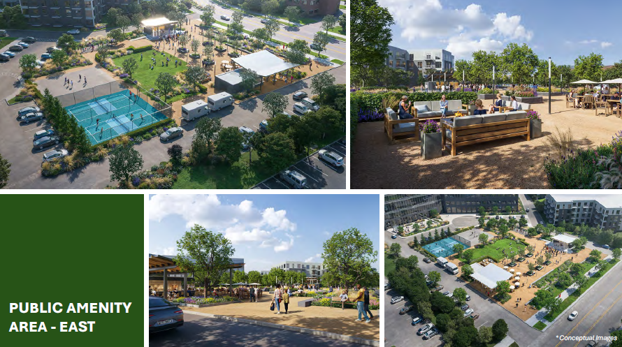
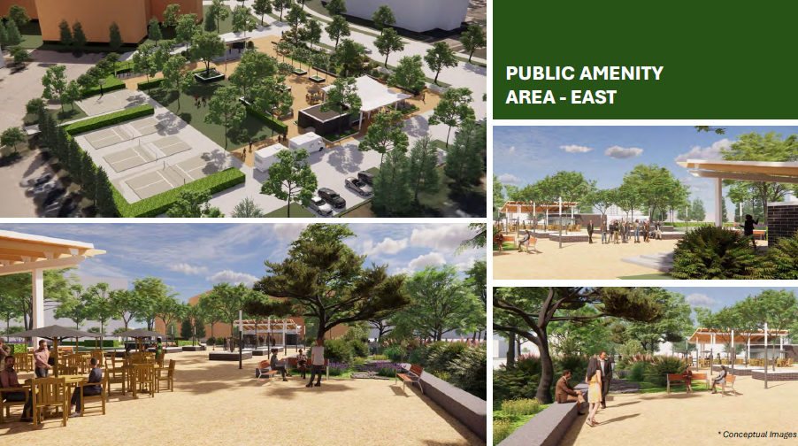
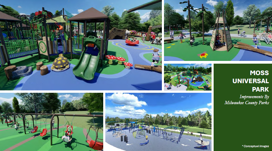
- Foster collaboration through public amenities. Develop plazas, parks, and recreational trails that encourage social interaction, active lifestyles, and year-around community use.
- Enhance transportation infrastructure. Redesign, improve, and extend internal road network to support efficient traffic flow, safe intersections, and multimodal access.
- Introduce mixed-use. Strategically incorporate residential, retail, and hospitality uses into the office park to create a more vibrant live-work-play environment while reducing urban sprawl and encouraging more efficient land use.
- Strengthen placemaking & identity. Establish a cohesive design language and wayfinding system that defines the district as a modern, activated neighborhood rather than a traditional office park.
- Generate long-term economic value. Position the district to attract and retain businesses, residents, and visitors through strategic land use, amenities, and activation that drive lasting investment and tax base growth.
View the Adopted Master Plan
Read the adopted master plan.
Drone Video & Project Purpose
Image 1 of 12